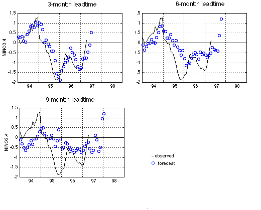
The average tropical Pacific sea surface temperature (SST) in the NINO3.4 region (5N-5S, 170W-120W) is often used as an El Nino index.
The figure shows our latest forecast using a neural network model trained with data up to April 1997. The three panels are for 3-, 6-, and 9-month leadtimes respectively. The black line is the observed SST, and the blue circles are forecasts.
Both the 6-month and the 9-month lead models indicate an increase of NINO3.4 in the coming months, possibly producing an El Nino event by the end of 1997. The wind data of April 1997 carries a strong warm-event precursor signal.
Click here for more detail about our model.