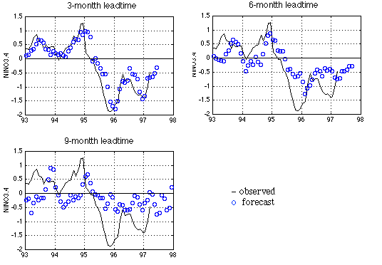
The average tropical Pacific sea surface temperature (SST) in the NINO3.4 region (5N-5S, 170W-120W) is used by CAC/NOAA as an El Nino index.
The figure shows our latest forecast using a neural network model trained with data up to March 1997. The three panels are for 3-, 6-, and 9-month leadtimes respectively. The black line is the observed SST, and the blue circles are forecasts. The tick mark on the time axis indicates January 1 of the year.
The more reliable 6-month lead model indicates a gradual return to a near normal condition in the Nino3.4 region for the next two seasons. Looking at the test performance, the current neural network models generally will not forecast an event until the April data become available.
Click here for more detail about our model.