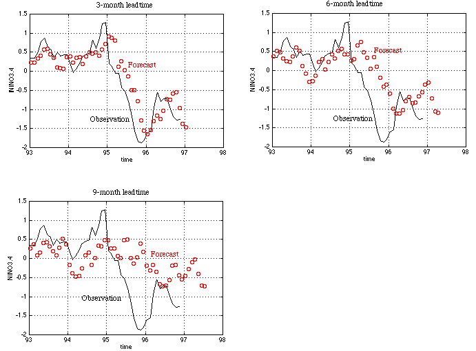
The average tropical Pacific sea surface temperature (SST) in the NINO3.4 region (5N-5S, 170W-120W) is used by CAC/NOAA as an El Nino index.
The figure shows our latest forecast using a neural network model trained with data up to October 1996. The three panels are for 3-, 6-, and 9-month leadtimes respectively. The black line is the observed SST, and the red circles are forecasts. The tick mark on the time axis indicates January 1 of the year.
Our forecast calls for a moderate cold tropical condition in the rest of 1996 and the first season of 1997.
This forecast was generated by a severely pruned model (version 1.2).